Skip to content
Geographical Analysis
  • Home
  • About Us
  • General Blog
  • Gis Blog
  • Maps
  • Shapefile
  • Contact Us

Gis Blog

Navigating The World – A Guide To Map Reading And Geographic Skills

January 26, 2024 by Admin

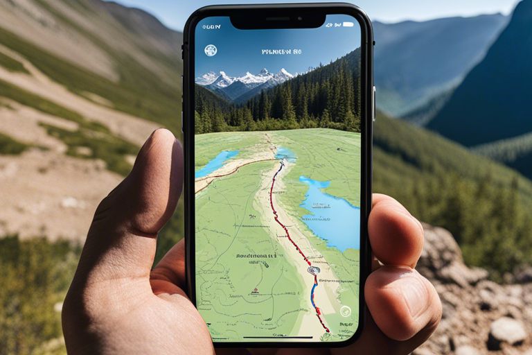
Are you ready to embark on a journey of exploration and discovery? In today’s modern world, the ability to read … Read more

Categories Gis Blog Tags Geographic skills, Map reading, Navigation

QGIS 2.18 free download (Direct Link)

August 31, 2023August 31, 2023 by Admin
qgis 2.18 free download

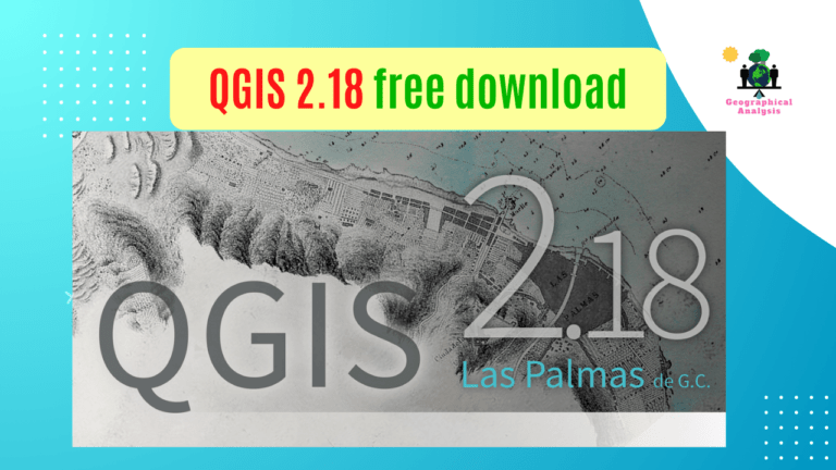
Introduction Looking for QGIS 2.18 free download options? You’re in the right place! Whether you’re using a 64-bit or 32-bit … Read more

Categories Gis Blog Tags qgis 2.18, qgis 2.18 free download

How to Fix Invalid Geometry Error in QGIS

August 16, 2023 by Admin
Fix Invalid Geometry Error in QGIS

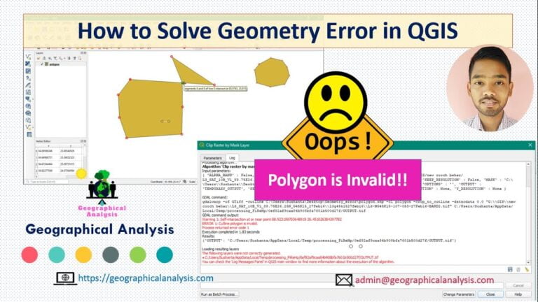
Discover how to resolve the Invalid Geometry Error in QGIS effortlessly. Learn step-by-step techniques to fix this common GIS challenge. … Read more

Categories Gis Blog Tags Fix Invalid Geometry Error in QGIS

How to Download QGIS latest Version on Your Computer?

March 20, 2023 by Admin
Download QGIS - Visit QGIS Official Website

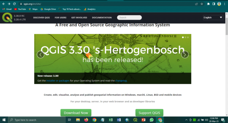
Download QGIS, a free and open-source Geographic Information System (GIS) program that lets you view, edit, and analyze geospatial data. … Read more

Categories Gis Blog Tags Download QGIS, Download QGIS on Windows, qgis, QGIS all version, QGIS Download

ArcGIS vs QGIS – Which GIS Platform is Right for You?

April 21, 2023February 15, 2023 by Admin
ArcGIS vs QGIS

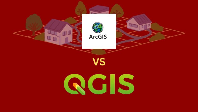
Are you looking for the right GIS platform for your project? With so many different options on the market, it … Read more

Categories Gis Blog Tags ArcGIS, arcgis vs qgis, gis, qgis

Discover the Power of ArcGIS Online: A Beginner’s Guide to Getting Started!

June 16, 2023February 7, 2023 by Admin
ArcGIS online

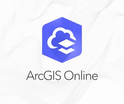
Are you ready to explore the power of GIS and map data? ArcGIS Online is a robust platform that can … Read more

Categories Gis Blog Tags ArcGIS, arcgis online, arcgis online download, arcgis online free, arcgis online login, arcgis online tutorial

(2024) India Shapefile with all States and Districts

May 24, 2024November 26, 2022 by Admin
India Shapefile with all States

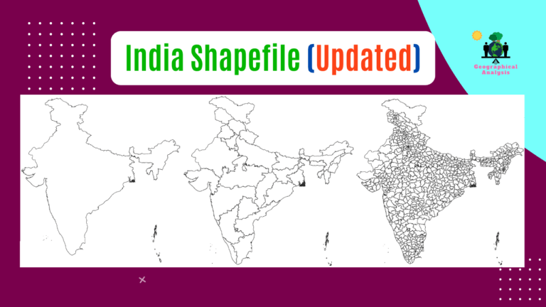
Three types of shapefiles are available here. Visit our Product Page: At the moment, India consists of 28 states and … Read more

Categories Gis Blog Tags India Shapefile download with Kashmir, Indian map Shapefile with all states, India boundary shapefile, qgis shapefile download

api-ms-win-crt-runtime-l1-1-0.dll is Missing Error Show when Opening QGIS Software

November 26, 2022 by Admin
api-ms-win-crt-runtime-l1-1-0

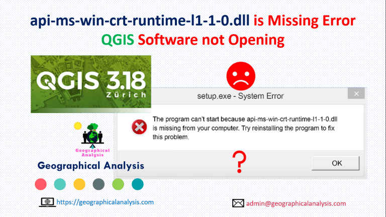
The program can’t start because api-ms-win-crt-runtime-l1-1-0.dll is missing from your computer. This error show when opening qgis software. Follow this … Read more

Categories Gis Blog Tags api-ms-win-crt-runtime-l1-1-0, download api-ms-win-crt-runtime-l1-1-0, qgis error show api-ms-win-crt-runtime-l1-1-0 missing, qgis not opening, qgis not opening after update

What is Dem, Slope, Aspect and Hillshade

November 26, 2022 by Admin
dem

What is Dem? A Digital Elevation Model (DEM) may be a specialized database that represents the relief of a surface between points … Read more

Categories Gis Blog Tags dem slope aspect hillshade, digital elevation method, what is aspect, What is Dem, what is hillshade, what is slope

Unsupervised Image Classification using KMeans Classification in QGIS

November 26, 2022 by Admin
unsupervised

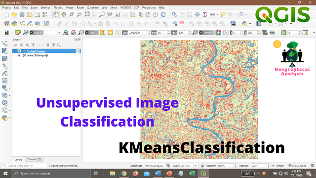
Unsupervised classification is done on software analysis. It uses computer techniques to determine the pixels which are related and group … Read more

Categories Gis Blog Tags k-means clustering qgis, kmeans classification, kmeansclassification, KMeansClassification in QGIS, orfeo toolbox, unsupervised classification qgis
Older posts
Newer posts
← Previous Page1 … Page3 Page4 Page5 Next →

Recent Posts

  • Top 10 Powerful Alternatives to Google Earth Engine for Advanced Geospatial Analysis
  • Indian Railways to begin trials of India’s first hydrogen train in Dec 2024 – Know the speed & routes
  • CSIR NET Application Form 2024, Eligibility, Exam Date, csirnet.nta.ac.in
  • Exploring The Seven Continents – A Journey Through Diverse Geographies And Serene Landscapes
  • Unveiling Hidden Gems – Top 10 Islands To Visit For Unique Geographical Experiences
  • The Shape Of Our Planet – Understanding The Role Of Oceans And Mountains In Geography
  • The Power Of Geography – How Oceans And Mountains Influence Weather Patterns And Climate
  • From Peaks To Depths – A Comparative Study Of Major Mountain Ranges And Ocean Depths
  • Continental Drift – How Plate Tectonics Shape Our Geography And Create Beautiful Landscapes
  • Islands Of Enchantment – The Geography And Culture Of The World’s Most Stunning Islands

Categories

  • agriculture
  • Europe
  • General Blog
  • Gis Blog
  • Gujarat
  • Haryana
  • India
  • Maps
  • Mexico
  • Natural Wonders
  • New York
  • Punjab
  • Shapefile
  • Software
  • Solar Energy
  • United Kingdom
  • United States
  • Uttarakhand

YouTube Videos

Geographical Analysis Logo

This is a blog website related to Geography and various geographical aspects. Geography, maps, remote sensing, GIS, landforms and places.

Follow Us!

Follow Us on FacebookFollow Us on TwitterFollow Us on YouTube
Map GIS

Needs any Custom map?

✉️ ad***@ga*******.com

  • Privacy Policy
  • Disclaimer
  • Terms and Conditions
© 2025 Geographical Analysis